GPS & DGPS – Automated positioning for all of your surveys
GPS – Positioning options for accurate global surveys
The use of Global Positioning Satellite (GPS) technology is now core to all earth science disciplines. Advances in the last 20 years with respect to GPS technology has made it easier and easier to accurately position data on a global basis.
GEM believes that the high quality results that our magnetometers provide should be accurately positioned and we offer a number of options for precise positioning. Benefits include the ability to see your data accurately positioned quickly following a survey for immediate follow-up and interpretation. This allows better and faster decision making.
Examples of typical applications include:
- Surveying in remote locations with no grid system (for example, in the high Arctic for diamond exploration)
- High resolution resource exploration mapping
- UAV flight path and mission planning
- High productivity ferrous ordnance (UXO) detection
- Accurate ground portable magnetic and gradient surveying for environmental and engineering applications
- Accurate time synchronization for diurnal corrections with magnetic base stations, for no fuss or user errors when making diurnal corrections for the magnetometer.
GEM – GPS Solutions
GEM offers a range of options to meet various customer needs. GEM addresses our customer requests for GPS and its higher resolution derivative, Differential GPS (DGPS) through both built-in and external GPS options. Built-in GPS offers many advantages because it minimizes weight and removes bulky components that can be damaged through normal survey procedures.
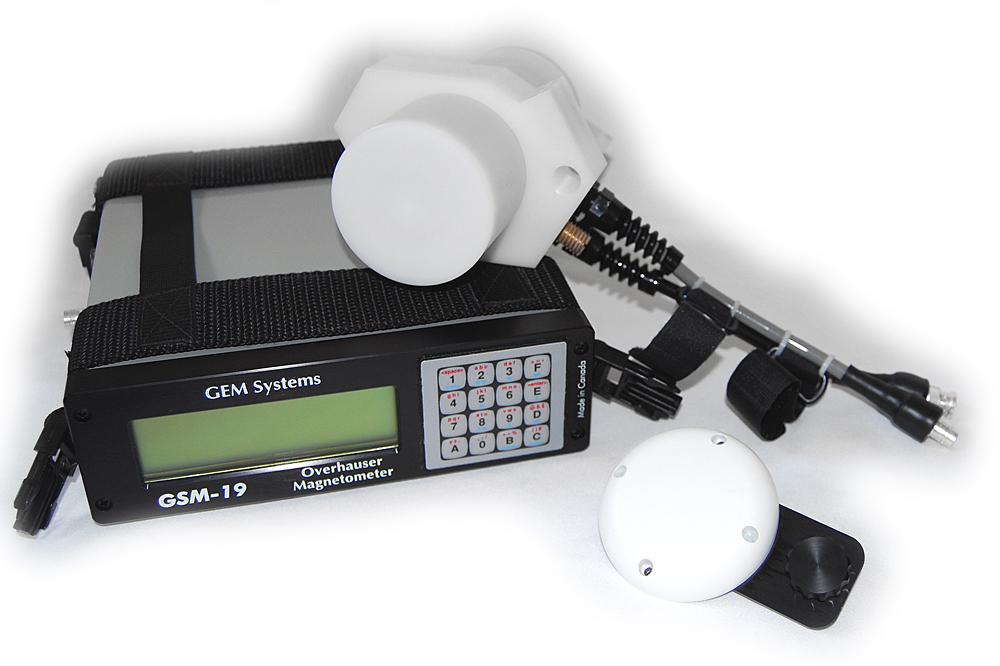
GEM Overhauser System with GPS

Multi Geophysics System with GPS (Mag, GRAD, VLF-EM)
Some customers, for example, want a very simple GPS solution that only provides time synchronization for very accurate base station work. Other customers require an advanced DGPS solution with centimeter positioning accuracy for highly detailed survey results.
- Standard GPS for surveying globally. This provides upto 1.5 m accuracy in normal operating mode. In areas where there is SBAS coverage, this is 70cm accuracy.
- Advanced GPS – in areas where SBAS does not exist or in situations where accuracy of the survey is required to the cm. This is an upgraded GPS board and it can utilise the Novatel “Correct” subscription system which can provide either 40 cm or 4 cm accuracy
- GPS Time monitoring for time synchronization for base station corrections.
All options, with the exception of the base station option, give you access to a unique Navigation package which includes:
- Conversion to Universal Transverse Mercator (UTM) coordinates
- Coordinate rotation for working on arbitrarily oriented grids
- Lane guidance with notification of lane deviation
For More information on GPS in General.. See below.
Custom Solutions
GEM systems uses built-in GPS boards that are carefully selected for performance and non-magnetic properties.
GPS – A summary
GPS basics – understanding positioning accuracy and navigation-a cross-section of terms and alternatives
Basic GPS – GNSS – “Global Navigation Satellite Systems”
Accuracy of GNSS (GPS,Glonass, Galileo, Beidou etc.) data at the time of collection can vary significantly due to several reasons, including but not limited to the following.
- Atmospheric (mainly Ionospheric) signal interference
- Number and angle of supported constellation satellites in view
- Signal “Multi-path” propagation / reflection
- Connected antenna location and configuration
Typically accuracy is in the range of 1 to 10 metres depending on what type of receiver is used. Basic GPS service with GEM provides accuracy in the 1.5 – 2 m accuracy.
For those who want to learn more about general GPS principles, you may want to refer to www.Novatel.com – Introduction to GNSS positioning. This resource provides a good overview from one of the premier hardware manufacturers.
The next best level of accuracy that users can achieve is with DGPS (differential GPS). This is usually obtained by applying corrections, , utilizing a GPS base station. (much like a magnetic base station). This can be cumbersome to do on a regular basis, so the international community decided to provide base stations and corrections for public use. This is accomplished automatically through an additional network of satellites and is provided free in certain regions of the world. This service is called SBAS. SBAS incorporates 4 regionally provided services which cover areas in North America, Europe, India and parts of Asia. SBAS provides “corrected” readings for GNSS data. When operating in SBAS regions accuracy is improved to 70 cm for GEM’s standard GPS solution.
Global Map of SBAS coverage.

Explanation of Terms
- SBAS – Satellite Based Augmentation Systems which incorporates WAAS, EGNOS, GAGAN and MSAS.
- WAAS – Wide Area Augmentation System is a satellite-based augmentation systems (SBAS) that is designed to improve the accuracy and ensure the integrity of information coming from GPS satellite
- EGNOS – European Geostationary Navigation Overlay Service is Europe’s first venture into satellite navigation. It will augment the two military satellite navigation systems now operating, the US GPS and Russian GLONASS systems.
- GAGAN – GPS Aided GEO Augmentation System is India’s SBAS programme to cover the Indian subcontinent.
- MSAS – Multi-Functional Satellite Augmentation System are geostationary satellites. They are owned and operated by the Japanese Ministry of Land, Infrastructure and Transport and the Japan Meteorological Agency (JMA), and provide coverage for the hemisphere centred on 140° East; this includes Japan and Australia.
- Planned – AFI for Africa, SACCSA for South America, SBAS in Malaysia, SDCM – Russian GPS Coverage
- NovaTel Correct – Is a Paid Subscription system is a Satellite Based Augmentation Systems that transmit their corrections from orbiting satellites instead of ground-based transmitters.
- RTCM – Ratio Technical Commission for Maritime Services is a scientific and educational organization, focusing on all aspects of maritime radio-communications, radio-navigation, and related technologies. Various standards are established through this body.
- RTK – a way to use GPS measurements that provides real time centimetric positioning. It is essentially a GPS differential mode of operation using carrier phase measurements which is claimed to make use of the most accurate information delivered by the GPS system.
GEM Basic GPS/DGPS Options
- Standard GPS for surveying globally. This provides upto 1.5 m accuracy in normal operating mode. In areas where there is SBAS coverage, this is 70cm accuracy.
- Advanced GPS – in areas where SBAS does not exist or in situations where accuracy of the survey is required to the cm. We can provide the Novatel “Correct” system which yields 4 cm accuracy
- Time Synchronization for base station corrections.
|
Related Links |

REQUEST A CALLBACK
If you would like to receive a callback from GEM Systems.
NEWS and EVENTS